About the UK Geography Test
~7 min read · Updated April 2026
UK geography appears throughout the Life in the UK Test, school SATs, GCSE Geography and many quiz nights. Beyond exams, knowing the nations, capitals and major regions helps you navigate news, weather forecasts and everyday conversation in Britain.
This guide covers the four nations, the major cities, mountains, rivers and the cultural landmarks that define each part of the UK. Use the practice quiz to test recall.
The four nations
The United Kingdom is made up of four countries: England (capital London), Scotland (Edinburgh), Wales (Cardiff) and Northern Ireland (Belfast). Together they form 'the UK' — but 'Great Britain' refers only to England, Scotland and Wales (the largest island).
The British Isles is a wider geographical term that also includes the Republic of Ireland, the Isle of Man and the Channel Islands. The Republic of Ireland is an independent country, not part of the UK.
Capital cities and population centres
London is the UK capital and by far the largest city (around 9 million). Other major English cities: Birmingham, Manchester, Liverpool, Leeds, Sheffield, Bristol, Newcastle. Scotland's largest city is Glasgow (capital is Edinburgh). Wales: Cardiff and Swansea. Northern Ireland: Belfast and Derry/Londonderry.
England has nine official regions, including London, the South East, North West and Yorkshire & the Humber. Scotland is divided into 32 council areas; Wales into 22 principal areas; Northern Ireland into 11 districts.
Mountains, rivers and coast
Highest peaks: Ben Nevis in Scotland (1,345 m — highest in the UK), Snowdon / Yr Wyddfa in Wales (1,085 m), Scafell Pike in England (978 m), Slieve Donard in Northern Ireland (850 m).
Longest rivers: Severn (354 km — flows from Wales through England), Thames (346 km — through London), Trent, Great Ouse, Wye. The Lake District (England) and Loch Lomond (Scotland) are the most famous lakes; Loch Ness is the deepest.
Famous landmarks
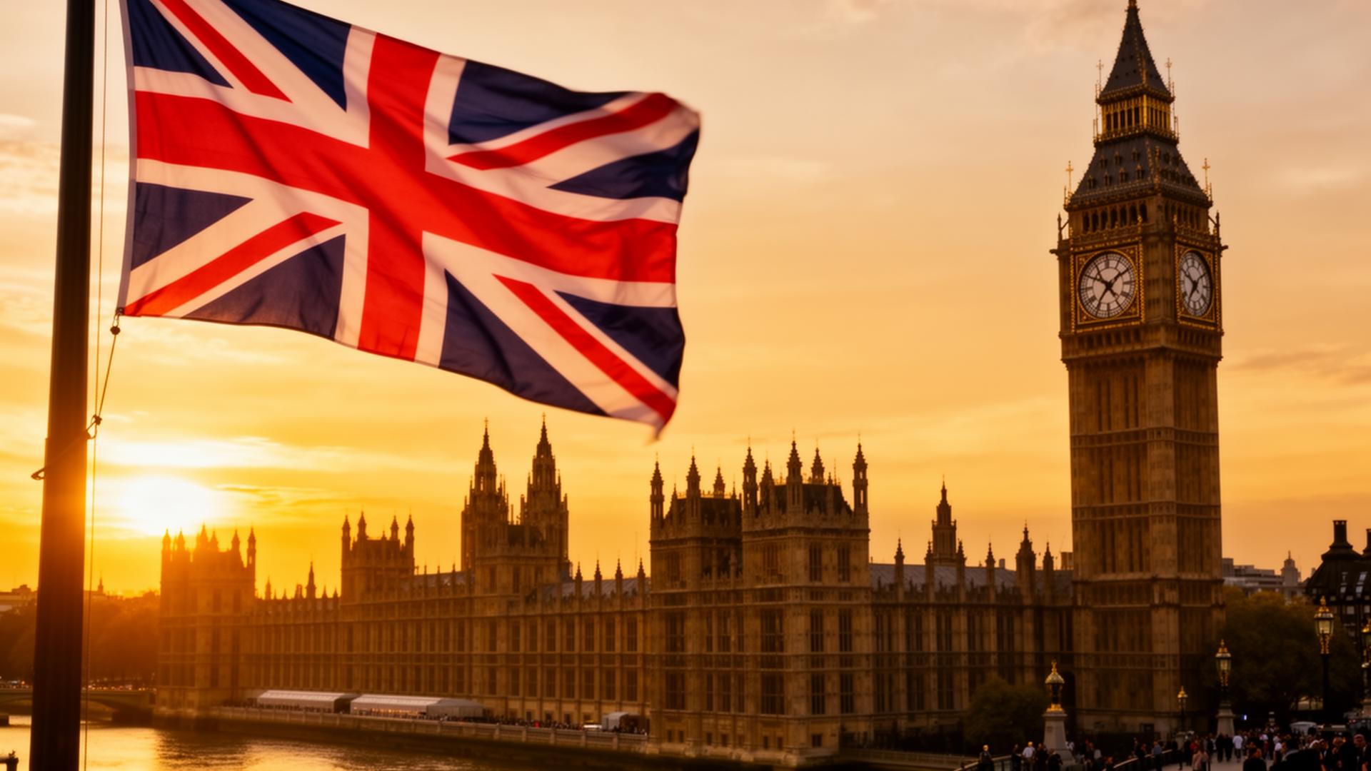
Stonehenge (Wiltshire), Hadrian's Wall (Northumberland), the Tower of London, Buckingham Palace, Big Ben (the Elizabeth Tower), Edinburgh Castle, Snowdonia / Eryri National Park, the Giant's Causeway (Northern Ireland), the White Cliffs of Dover, the Angel of the North (Gateshead).
Many appear in Life in the UK Test questions — learn at least one famous landmark per nation and the era it dates from.
Patron saints and national symbols
Each nation has a patron saint and a feast day: St George (England, 23 April), St Andrew (Scotland, 30 November), St David (Wales, 1 March), St Patrick (Northern Ireland, 17 March).
National flowers: rose (England), thistle (Scotland), daffodil/leek (Wales), shamrock (Northern Ireland). The Union Jack combines the crosses of St George, St Andrew and St Patrick — Wales is not represented because it was already part of the Kingdom of England when the flag was designed.
Climate, weather and time
The UK has a temperate maritime climate: mild winters, cool summers, rain spread throughout the year. The west (Cornwall, Wales, west Scotland) is wetter; the east (East Anglia, Lincolnshire) is the driest. The Lake District and west Highlands get over 3,000mm of rain a year — enough to support temperate rainforest.
Standard time is Greenwich Mean Time (GMT, UTC+0). The clocks go forward one hour on the last Sunday of March (British Summer Time, BST, UTC+1) and back on the last Sunday of October. The Meridian line runs through Greenwich in south-east London — the basis of world time zones.
Crown Dependencies and Overseas Territories
The Isle of Man, Jersey and Guernsey are Crown Dependencies — self-governing possessions of the Crown, not part of the UK or EU. They have their own parliaments, currencies (pegged to sterling) and tax systems. British citizens have the right to live and work there but need permission for permanent residency.
Fourteen British Overseas Territories include Gibraltar, the Falkland Islands, Bermuda, the Cayman Islands and the British Virgin Islands. They are not part of the UK but residents can apply for British Overseas Territories citizenship and, in most cases, full British citizenship.
Devolution and how the nations are governed
Since 1999, Scotland, Wales and Northern Ireland have devolved governments with powers over health, education, transport and (in Scotland) some taxes. England has no separate parliament — its laws are made at Westminster. The Senedd (Welsh Parliament) sits in Cardiff Bay; the Scottish Parliament at Holyrood, Edinburgh; the Northern Ireland Assembly at Stormont, Belfast.
Reserved matters — defence, foreign affairs, immigration, monetary policy — remain at Westminster for all four nations. The UK Parliament can in theory legislate on any matter, but by convention does not legislate on devolved areas without consent.
Ready to start?
You've read the guide — now put it into practice. 45 of 45 mock papers ready, each with 24 questions and full explanations.
Start UK Geography Test